Description
Product Features:
Navionics hotmaps platinum lake maps - east - microSD™/SD™
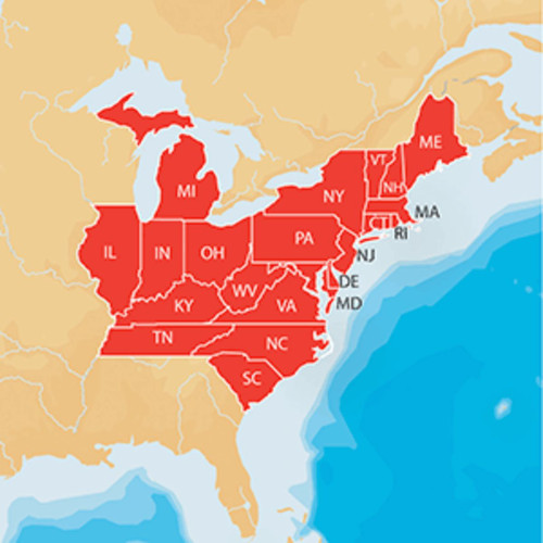
East: covers CT, DE, IL, IN, KY, MA, MD, ME, MI, NC, NH, NJ, NY, OH, PA, RI, SC, TN, VA, VT, WV
One foot contours
21,000 lakes and growing
Daily updates and advanced features for one year
Manufactured by Navionics Electronic Charts
Dimensions: 1"H x 7"W x 5"D
Material(s): metal
Product Specifications
| Item Dimensions | 7.00"L x 5.00"W x 1.00"H |
|---|---|
| Item Weight | 0.20 LBS |
| Item SKU | DCWR 37637 |
| Batteries | No battery used |
| Number of Pieces | 1 |
Shipping
Lead time to ship: 2 business days
Returns
Please visit the Christmas Central Store for information on returns.
The details of this item were provided by a Christmas.com marketplace partner. Christmas.com does not represent or warrant that this information provided is complete or accurate. Occasionally, manufacturers may modify their items and update their labels. Christmas.com recommends that you do not solely rely on the information presented in this listing. If you have any questions, comments, or concerns about this item you may consult the label of the item, contact the manufacturer, contact the marketplace partner, or contact Christmas.com via email or phone.
If the details of this item are not accurate or are incomplete, please contact us. Report product info.

